<img src="http://images.adsttc.com/media/images/590b/5bb7/e58e/cef4/3f00/0416/original/maps_ad.gif">
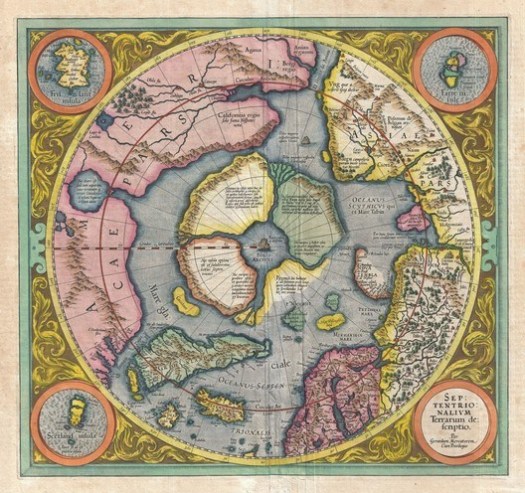
The First Map of the North Pole (1606)
 Septentrionalium Terrarum. Image © Gerard Mercator (Public Domain)
The Septentrionalium Terrarum, completed in 1606 by Gerard Mercator (of projection fame), presents the North Pole as an enormous mountain surrounded on all sides by sea and four giant land masses. Without any information about what lay "up there," Mercator also described


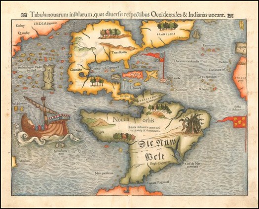
The First Map of the American Continent (1550)
 Tabula novarum insularum, quas Diversis respectibus Occidentales & Indianas uocant. Image © Sebastian Münster (Public Domain)
The Tabula novarum insularum, quas Diversis respectibus Occidentales & Indianas uocant or, to put it more concisely, the first map of the American continent, by Sebastian Münster (1550) is the earliest known map to present all of North and South America in a "true" continental form. While North America suffered immeasurably from a lack of understanding of both scale and distance (a large ocean inlet is seen to cut between what might now be the USA and Canada), the outline South America is slightly closer to reality.
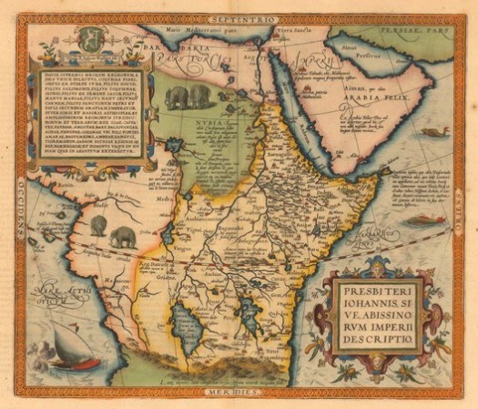
An Early Map of the African Continent (1573)
 Prester John, or, a map of the Abyssinian Kingdom. Image © Abraham Ortelius (Public Domain)
  <div class="buy-publication">
    <!-- Publication Cover -->
    <div class="buy-publication__cover">
      <img class="buy-publication__img" src="http://images.adsttc.com/media/images/590b/49bc/e58e/cef4/3f00/03b7/small_portrait/open-uri20170504-2480-1oas9x1.jpg?1493911993" />
    </div>
    <!-- Publication Title -->
    <div class="buy-publication__title">
      The Phantom Atlas: The Greatest Myths, Lies and Blunders on Maps
    </div>
    <!-- Publication Buying options -->
    <div class="buy-publication__buttons">
            <a class="afd-btn btn-overwrite btn-buy-from-amazon" href="http://www.amazon.com/gp/aws/cart/add.html?AssociateTag=arch05-20&SubscriptionId=AKIAJWGDIZLQV3SHSCPA&ASIN.1=1471159450&Quantity.1=1" >
    <div class="amazon-buy-from">
      Buy from
    </div>
    <div class="amazon-site">
      amazon.com
    </div>
  </a>
    </div>
  </div>
<img src="http://feeds.feedburner.com/~r/ArchDaily/~4/dwHoGl2M-Iw" height="1" width="1" alt=""/>
